|
Picture: market square of Bruges |
| start > gb > arounddamme > fort of bavaria |
|
» Aardenburg » Abbey of Ter Doest » Adegem » Bruges » Castle of Middelburg » Donk » Dudzele » Fort of Bavaria » Knokke-Heist » Koolkerke » Lissewege » Maldegem » Male » Middelburg » Oedelem » Sint-Anna-Ter-Muiden » Sluis
|
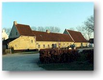
The fort of Bavaria
The Northern armies occupied again the old fortresses that were built during the 80-year war (1568-1648), amongst which the fortress of St.-Donaas. The French sent Vauban to Bruges with the instruction to organise a defence line. Part of this defence line was the construction of the fortress of Bavaria, between Koolkerke and the present Damse Vaart (only dug in 1810). It consisted of earth walls and ditches in the shape of a 5-star. 5 balatjons of soldiers were stationed in the camp. However, the fortress was never attacked. When Flanders was occupied by the English and the Northern Netherlands, the fortress had no use anymore. In 1715, Flanders was governed by Austria. The last soldiers left the stronghold in 1748. It was used one last time by the Germans during World War II.
The ditches and the earth walls are still largely visible. There are also still a few remainders of the castle such as the garden, the green-house and an ice cellar. There is a great variety of wildlife to be seen. The entire domain now is a protected landscape and property of the province of West-Flanders. The fortress is on 'biking distance' from the center of Damme and is easiest reached by following the Damse Vaart in the direction of Bruges. Worth a trip.
|
|


 Prelude.
We write the year 1700: the Spanish king Charles II dies without
direct successor. The Southern Netherlands belonged till then
to the Spanish Crown. There were two European monarchs who
claimed the throne: Leopold I (emperor of Austria) and Louis XIV
(king of France). Louis XIV succeeded in having his grandson,
Phillips of Anjou, appointed as heir to the throne. As a result,
the French king could annex Flanders without difficulties and
stationed his army at the borders of the Northern Netherlands.
Of course, the "Dutch" were not pleased with this development.
The English from their side were very worried about the French
expansion. The emperor of Austria was of course not happy with
his defeat. As a consequence, Austria, England and the Northern
Netherlands allied their forces against France and they set as
goal to conquer the Southern Netherlands. In 1702, war was
declared.
Prelude.
We write the year 1700: the Spanish king Charles II dies without
direct successor. The Southern Netherlands belonged till then
to the Spanish Crown. There were two European monarchs who
claimed the throne: Leopold I (emperor of Austria) and Louis XIV
(king of France). Louis XIV succeeded in having his grandson,
Phillips of Anjou, appointed as heir to the throne. As a result,
the French king could annex Flanders without difficulties and
stationed his army at the borders of the Northern Netherlands.
Of course, the "Dutch" were not pleased with this development.
The English from their side were very worried about the French
expansion. The emperor of Austria was of course not happy with
his defeat. As a consequence, Austria, England and the Northern
Netherlands allied their forces against France and they set as
goal to conquer the Southern Netherlands. In 1702, war was
declared. 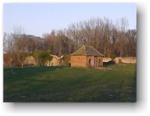 For
the construction of the fortress, the castle Stockhove had to be
torn down. Another castle from 1609 (Castle of Caloen) is
situated on the south-west side of the fortress. The day the
fort lost its military function, the domain was sold to the lord
of Van Caloen castle, who laid out a castle park on the premises.
This castle was pulled down in 1956.
For
the construction of the fortress, the castle Stockhove had to be
torn down. Another castle from 1609 (Castle of Caloen) is
situated on the south-west side of the fortress. The day the
fort lost its military function, the domain was sold to the lord
of Van Caloen castle, who laid out a castle park on the premises.
This castle was pulled down in 1956. |
© Hendrik De Leyn - www.damme-online.com |